
Understanding Airspace Classes: A Student Pilot's Guide to Navigating Class B Through G
Sep 28, 2026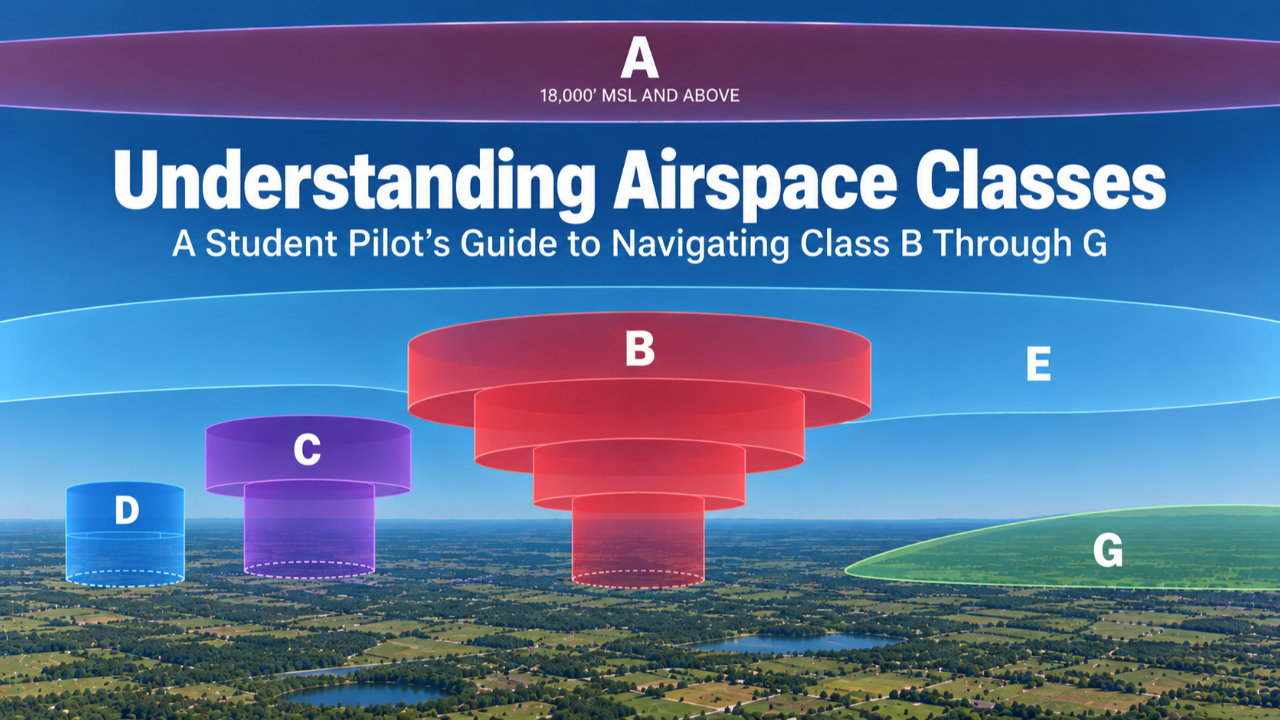
Before examining individual airspace classes, it helps to understand how the FAA organizes airspace as a system. Airspace exists to separate aircraft, manage traffic flow, and protect pilots and people on the ground. Each type has specific rules that determine who can operate there, what equipment is required, and whether air traffic control is involved.
How Airspace Is Organized
The FAA divides airspace into two broad categories based on how it is established and managed.
Regulatory airspace is created through federal regulation and carries clearly defined operating rules. This includes Class A through E airspace and Prohibited Areas. These airspaces are charted, standardized, and legally enforceable.
Nonregulatory airspace is established to alert pilots to unusual or hazardous activity but does not impose direct operating requirements. Military Operations Areas and Alert Areas are common examples. Pilots are not prohibited from flying through these areas but are expected to exercise increased caution.
Within these categories, airspace is further grouped by how it is controlled and used. For private pilot operations, you will encounter controlled airspace, uncontrolled airspace, special use airspace, and other airspace. This chapter covers where these airspaces exist, how to identify them on a chart, and what is required to operate safely and legally within each one.
Controlled Airspace
Controlled airspace is airspace where ATC provides services such as traffic separation, sequencing, and safety advisories. It includes Class A, B, C, D, and E. The level of ATC involvement and pilot requirements increase with traffic density and operational complexity.
Class A Airspace
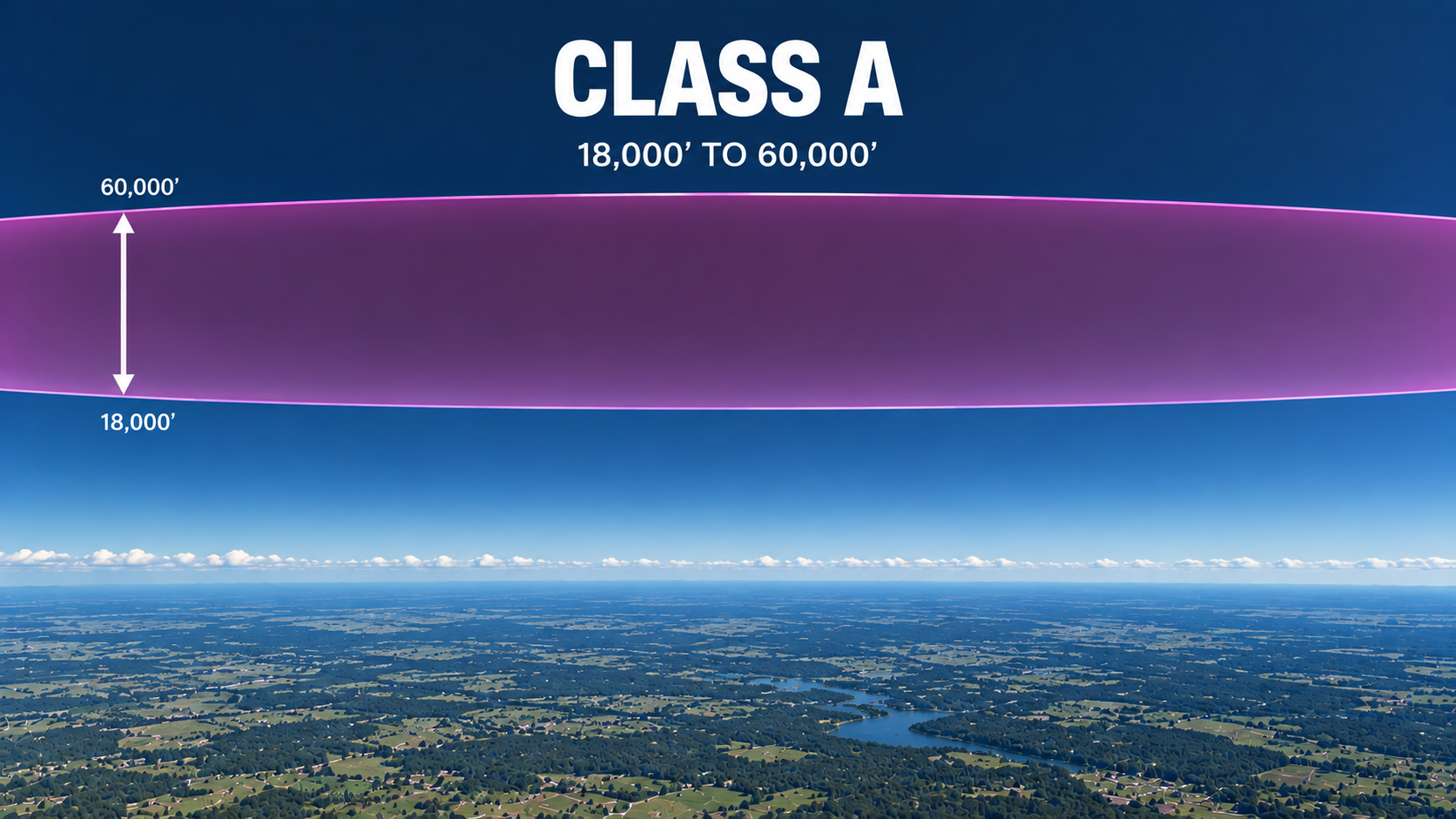
Class A airspace extends from 18,000 feet MSL up to 60,000 feet MSL across the entire United States. All operations within Class A airspace must be conducted under Instrument Flight Rules with an ATC clearance, which means you will not operate here as a VFR pilot. It remains part of the full airspace picture you are expected to understand for your written exam.
Class A Airspace Requirements:
Altitude Range: 18,000 feet MSL up to 60,000 feet MSL
ATC Communication: Required
ATC Clearance: Required, IFR only
Equipment: IFR-equipped aircraft
Note: VFR flight is not permitted in Class A airspace
Class B Airspace
Class B airspace surrounds the nation's busiest airports where traffic density is highest. It is designed to protect large volumes of arriving and departing aircraft by giving ATC maximum control over sequencing and separation.
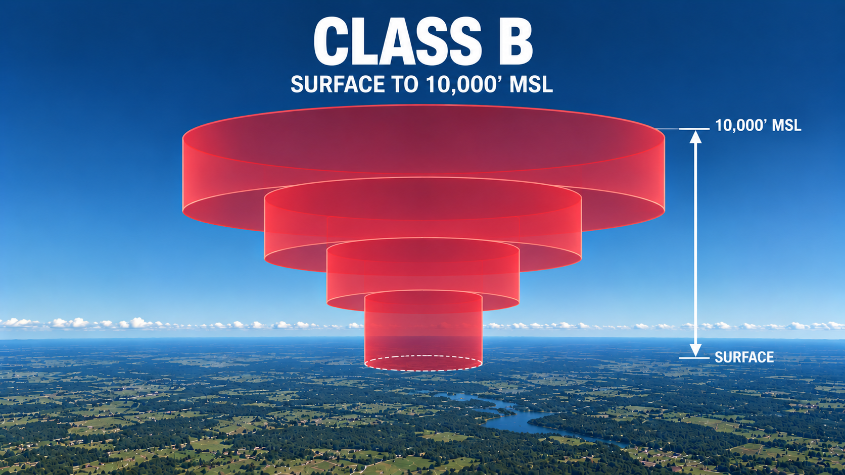
Class B airspace typically extends from the surface up to 10,000 feet MSL and is shaped like an upside-down wedding cake. This layered design allows ATC to route aircraft at different altitudes while keeping traffic organized.
To enter Class B airspace, you must receive an explicit clearance from ATC. Hearing your callsign alone is not sufficient. ATC must specifically say the words "cleared into Class Bravo airspace" or equivalent authorization before you may enter.
Class B Airspace Requirements:
Altitude Range: Surface to 10,000 feet MSL in defined layers
Shape: Upside-down wedding cake
ATC Clearance: Explicit clearance required prior to entry
Pilot Qualification: Private pilot certificate or higher, or student pilot with logbook endorsement
Equipment: Two-way radio, Mode C transponder, ADS-B Out
Bravo On Sectional Chart
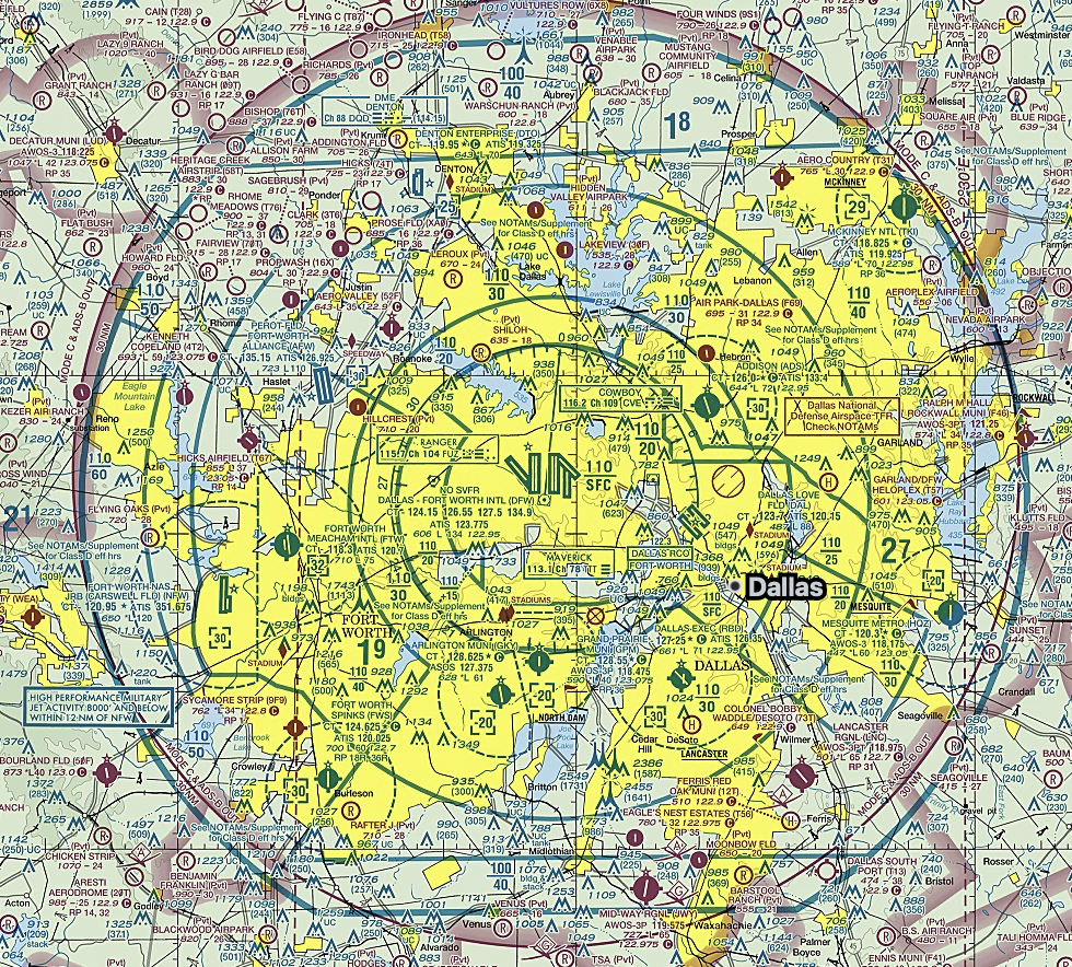
Bravo airspace is depicted with the blue circles.
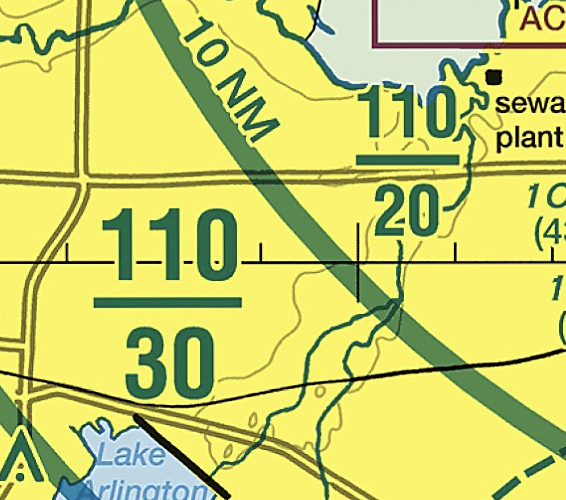
These are the different altitudes. You’ll see them in the bravo shelves. Above the bravo starts at 3,000 MSL and goes to 11,000 MSL and 2,000 MSL and goes to 11,000 MSL.
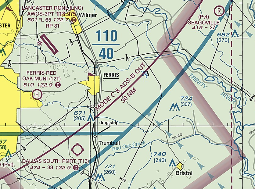
The Mode C Veil is the area within 30 nautical miles of a Class B primary airport, measured from the airport reference point, where every aircraft is required to have an operating transponder with Mode C altitude reporting, regardless of whether you actually enter the Class B airspace itself. This requirement extends from the surface up to 10,000 feet MSL, so even if you're flying well outside the visible boundaries of the Class B airspace on your sectional chart, you're still required to have that transponder running if you're inside the 30 nautical mile ring. ADS-B Out is also required within this same area under current equipment rules. The Mode C Veil exists so ATC can track and identify traffic operating near the busiest airspace in the country, even when that traffic never actually requests to enter the Class B airspace above it. On a sectional chart, this boundary is depicted as a thin magenta circle centered on the Class B primary airport.
Class C Airspace
Class C airspace is designed to manage traffic at airports with moderate airline and general aviation activity. While less complex than Class B, it still requires active communication between pilots and ATC to maintain safe spacing and traffic flow.
Class C airspace consists of two layers. The inner core extends from the surface to 4,000 feet AGL with a 5 nautical mile radius. The outer shelf extends from 1,200 feet to 4,000 feet AGL with a 10 nautical mile radius. This structure allows ATC to sequence arrivals and departures while accommodating aircraft transitioning through the area.
To enter Class C airspace, two-way radio communication must be established with ATC prior to entry. Unlike Class B, an explicit clearance is not required. Communication is considered established once ATC responds using your callsign.
Class C Airspace Requirements:
Altitude Range: Surface to 4,000 feet AGL (inner core), 1,200 to 4,000 feet AGL (outer shelf)
Radius: 5 NM inner core, 10 NM outer shelf
ATC Communication: Two-way radio contact required prior to entry
Equipment: Two-way radio, Mode C transponder, ADS-B Out
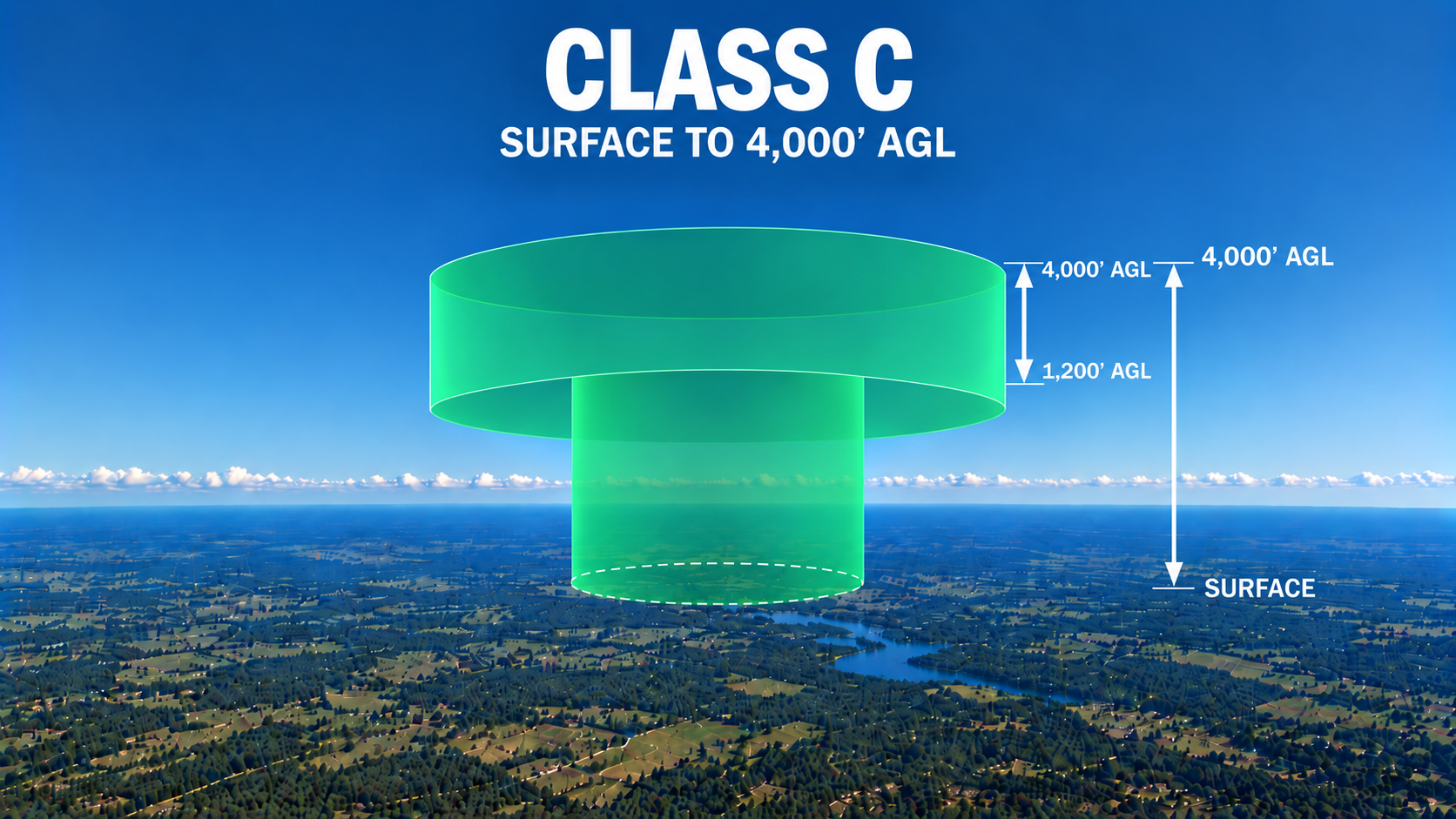
Charlie On Sectional Chart
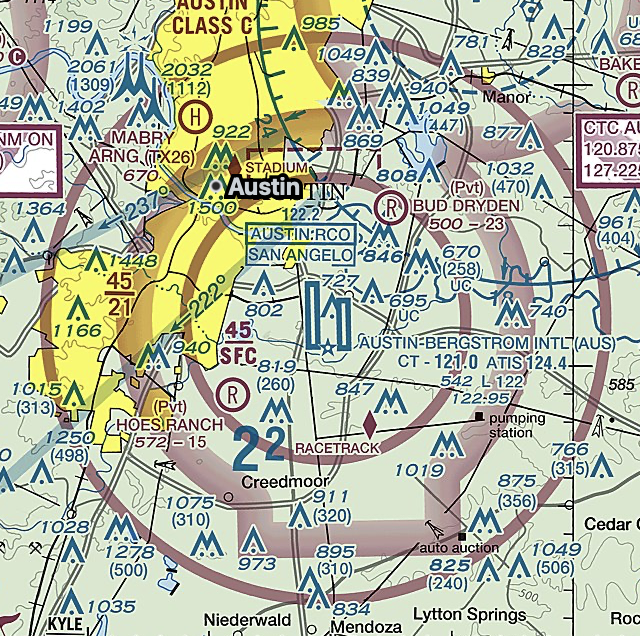
Class C is depicted with these magenta circles.
Class D Airspace
Class D airspace surrounds smaller towered airports and protects aircraft in the immediate airport environment. It is simpler in structure than Class B and C and handles lower traffic volumes.
Class D typically extends from the surface to 2,500 feet AGL with a radius of approximately 4 to 5 nautical miles. Exact dimensions are published in the Chart Supplement and depicted on sectional charts.
Two-way radio communication must be established with the tower prior to entry. ATC acknowledging your callsign satisfies the requirement. A transponder or ADS-B Out is not specifically required unless you are operating within airspace where those requirements already apply. When the tower closes, Class D airspace ceases to exist and reverts to Class E or G depending on the published configuration.
Class D Airspace Requirements:
Altitude Range: Surface to approximately 2,500 feet AGL
Radius: Approximately 4 to 5 NM
ATC Communication: Two-way radio contact required prior to entry
Equipment: Two-way radio
Note: Reverts to Class E or G when tower is closed
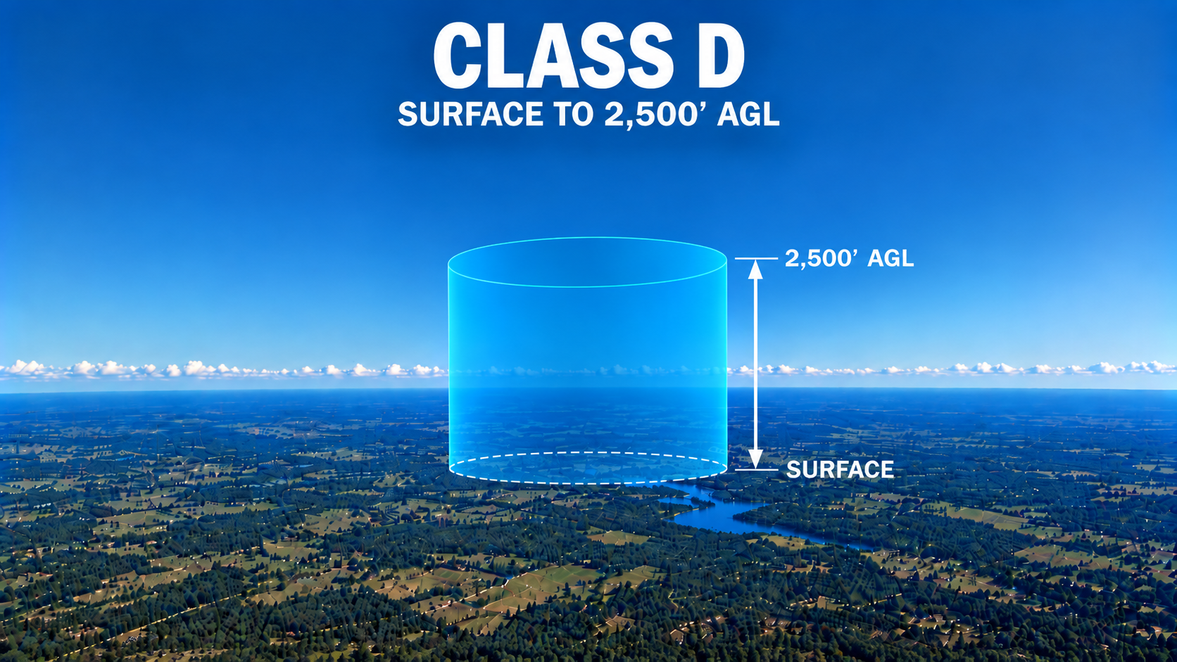
Delta On Sectional Chart
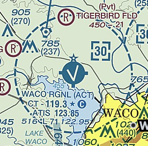
Delta airspace is depicted with blue dashed circles.
Class E Airspace
Class E is controlled airspace that does not fit into Class A through D. It serves as a transition area supporting both IFR and VFR operations where full ATC services are not required for VFR pilots.
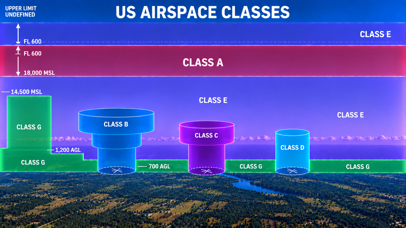
Class E begins where other controlled airspace ends and extends up to but not including 18,000 feet MSL. In most areas it starts at 1,200 feet AGL, but near airports with instrument approaches it may begin at 700 feet AGL or at the surface. Above FL600, airspace is also designated Class E.
VFR pilots do not need to contact ATC to operate in Class E but must comply with applicable weather minimums. IFR aircraft operate under ATC control while VFR aircraft operate independently within the same airspace.
Class E Airspace Requirements:
Altitude Range: Surface, 700 feet AGL, 1,200 feet AGL, or 14,500 feet MSL up to but not including 18,000 feet MSL
ATC Communication: Not required for VFR
Equipment: No specific requirement for VFR
Note: IFR aircraft operate under ATC control within Class E
Echo On Sectional Chart
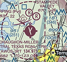
In some locations, Class E airspace extends all the way down to the surface, usually surrounding an airport with an instrument approach but no operating control tower. On a sectional chart, this is depicted with a dashed magenta line. Because there's no tower, this is the only way to provide controlled airspace protection for aircraft flying instrument approaches into that airport.
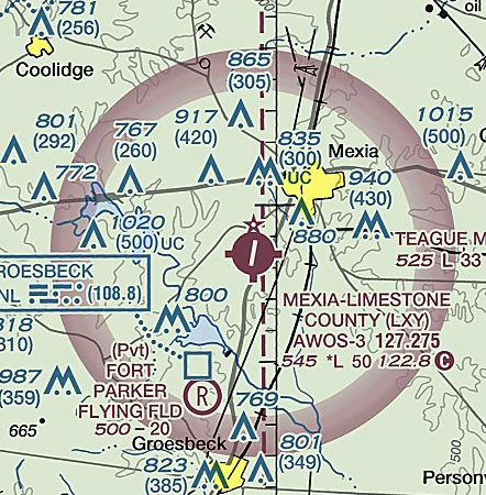
This is the most commonly seen variation. It's depicted on a sectional chart as a faded or vignette magenta circle surrounding an airport. Below 700 feet AGL in that area, the airspace is Class G. Above 700 feet AGL, it becomes Class E. This configuration typically exists to support instrument approaches at airports where full surface-based Class E isn't needed.
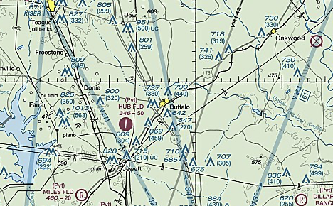
This is the default floor for Class E airspace when nothing else is depicted on the chart. If you don't see magenta shading or a dashed line indicating a different floor, Class E begins at 1,200 feet AGL by default. This is the most widespread version of Class E airspace across the country, since it fills in the space above Class G in areas without more specific airspace needs.
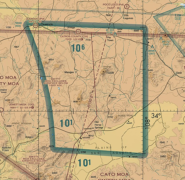
In many parts of the country, particularly over mountainous or remote terrain, Class E airspace also has a floor of 14,500 feet MSL. This exists above the Class G airspace found at very high altitudes in areas where lower controlled airspace hasn't been established, and it extends up to but not including 18,000 feet MSL, where Class A airspace begins.
Uncontrolled Airspace: Class G
Class G is uncontrolled airspace typically found close to the surface in areas with low traffic density. ATC does not provide separation services in Class G, and pilots are responsible for their own traffic awareness and weather compliance.
Class G begins at the surface and extends to the base of the overlying Class E airspace, typically 700 or 1,200 feet AGL. In remote areas where no controlled airspace exists above, Class G may extend as high as 14,500 feet MSL.
No ATC clearance or communication is required, but VFR weather minimums still apply. Class G is commonly encountered during takeoff, landing, and low-altitude operations.
Class G Airspace Requirements:
Altitude Range: Surface to the base of overlying Class E, up to 14,500 feet MSL in remote areas
ATC Communication: Not required
Equipment: No specific requirement
Note: VFR weather minimums still apply
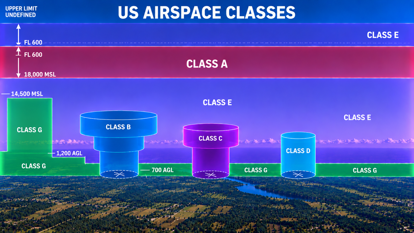
Reading a Sectional Chart for Airspace
The best way to build confidence with airspace is to practice reading a sectional chart directly. Solid blue lines typically indicate Class B airspace, solid magenta lines indicate Class C, dashed blue lines indicate Class D, and fading magenta shading indicates where Class E airspace begins at 700 feet AGL. A dashed magenta line indicates Class E airspace beginning at the surface rather than at 700 or 1,200 feet AGL. Numbers inside the airspace boundaries tell you the floor and ceiling altitudes for that layer. Cross reference what you find with a digital tool such as ForeFlight or SkyVector to check your work, or ask your instructor to walk through a few examples with you if something isn't clicking yet.
Airspace only feels complicated the first time you look at it. Once you understand what each class represents, what equipment it requires, and how ATC involvement changes from one class to the next, reading a sectional chart becomes second nature. Knowing your airspace isn't just a written exam requirement, it's a core piece of flying safely and legally every time you go up. Spend time practicing with real charts and real airports near you, and this topic will click faster than you expect.